Let’s Play Portend: A Look at How El Niño May Affect Supply Chains in 2026–27
A weather pattern developing thousands of miles from your suppliers can still arrive at your warehouse. It just tends to show up disguised as something more familiar: a delayed vessel, a flooded road, a constrained factory, a smaller crop—or an invoice with an unwelcome new line item.
That is El Niño’s particular talent. It begins as a shift in the tropical Pacific and then travels through waterways, farms, power grids, inland corridors, and freight networks until the forecast becomes operational.
The stakes extend well beyond cargo. Recent extreme weather across Asia has caused catastrophic flooding, displacement, and significant loss of life. Any discussion of supply-chain exposure sits beneath that human reality. The same hazards that delay a shipment can devastate a community, and preparedness matters first because people are at risk.
For importers, the task is neither to panic nor to pretend the forecast is background scenery. NOAA reported in August that El Niño was strengthening, with more than a 90% chance of becoming a very strong event during fall and winter 2026–27. In early September, the World Meteorological Organization said the event was firmly established and likely to persist through February 2027.
No two El Niño events follow the same itinerary, and a seasonal outlook is not a shipment-level forecast. Still, the signal is strong enough to warrant a closer look. So let’s play portend—not by predicting every disruption, but by identifying where pressure may build and what importers can do before the weather report starts appearing on the freight bill.
El Niño Without the Meteorology Degree
El Niño is the warm phase of the El Niño–Southern Oscillation, or ENSO: a recurring shift in ocean temperatures and atmospheric circulation across the tropical Pacific. It typically develops every two to seven years and can rearrange rainfall, temperature, and storm patterns far beyond the Pacific itself.
Think of it as a global weather influencer—minus the ring light and sponsored content. It is not one storm, and it does not produce one uniform forecast. It can bring drought to one sourcing region, excessive rainfall to another, and a different tropical-cyclone pattern to the oceans connecting them.
The current event warrants attention because of its projected strength. NOAA’s August outlook placed the chance of a very strong event above 90%, while stressing that even a powerful El Niño does not guarantee any specific regional outcome. That distinction is important: this is a reason to prepare around elevated risk, not an invitation to treat every historical impact as a scheduled encore.
The Previous Forecast Is Not a Routing Guide
Historical El Niño events offer a useful playbook, but not a perfect preview. The major events of 1982–83, 1997–98, 2015–16, and 2023–24 disrupted weather patterns, agriculture, transportation infrastructure, and regional economies. The locations and severity varied. The supply-chain lesson did not: disruption rarely stays where the weather happens.
During the 1997–98 event, heavy rainfall and flooding affected parts of western South America and East Africa while drought gripped Indonesia and Australia. The 2015–16 event again brought severe drought to parts of Southeast Asia and southern Africa, contributing to crop stress, water shortages, and food-price pressure.
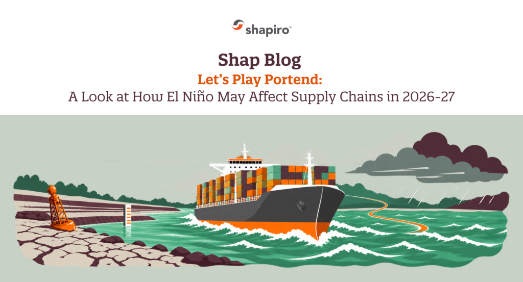
The most familiar logistics example is more recent. Drought during the 2023–24 El Niño lowered water levels in the Panama Canal watershed, forcing reductions in daily transits and vessel drafts. Some ships carried less cargo. Others waited for scarce reservation slots. Some services considered longer alternatives. One rainfall deficit became a capacity problem, then a scheduling problem, and—because supply chains enjoy a three-act structure—a cost problem.
That precedent matters now. After initially indicating that restrictions were not expected for 2026, the Panama Canal began reducing daily transits again as rainfall fell below normal. Current plans reportedly lower daily crossings from 36 to 32 and reduce the maximum draft for certain vessels beginning in October. Details may change with rainfall, but the commercial message is already clear: canal resilience can improve; freshwater still gets the final vote.
Conditions Already on the Map
El Niño’s atmospheric pattern is no longer theoretical. NOAA has observed increased rainfall over the central and eastern Pacific and suppressed rainfall over Indonesia. The WMO also expects warmer and wetter conditions across much of the Greater Horn of Africa during the final quarter of 2026, with heightened risks of flooding, crop damage, and infrastructure disruption in some areas.
Meanwhile, parts of Central America are confronting worsening dry conditions, and the Panama Canal is taking operational steps to conserve water. These are different hazards with one shared result for trade: less predictability at origins, production sites, inland corridors, and gateways.
Visible weather damage is often only the first layer. Flooding may close a road for days; congestion and container imbalances can linger much longer. Drought may reduce a harvest, then affect processing schedules, export availability, and prices for months. The physical event may be local. The recovery timeline rarely observes the same boundary.
The Trade Forecast
WATERWAYS AND MARITIME CAPACITY
Freshwater with a chance of surcharges
The Panama Canal remains the clearest pressure point because its locks depend on water stored in Gatún and Alhajuela Lakes. Fewer transits or shallower draft limits reduce effective capacity even while ships continue moving.
Carriers may respond with load restrictions, surcharges, altered rotations, intermodal alternatives, or longer routes. In shipping terms, that is a broad range of creative ways to say “more time and money.”
Other waterways can face the opposite problem. Excess rainfall may interrupt the river, road, and rail links feeding ports, while extremely low water can constrain inland barge traffic. Watch the corridor around a gateway, not only the gateway itself.
AGRICULTURE COMMODITIES AND RAW MATERIALS
Uneven yields with downstream price pressure
Weather-sensitive goods often feel El Niño early. Rice, palm oil, sugar, coffee, cocoa, rubber, grains, seafood, and other agricultural or natural-resource products may face drought, excessive rain, heat, or changing ocean conditions, depending on origin.
The first effect may be lower yield or quality. Then comes the commercial weather system: tighter export availability, higher input costs, supplier allocation, government trade controls, or shifts to substitute origins. Even companies that do not import food directly may feel the impact when these commodities feed packaged goods, chemicals, textiles, biofuels, or industrial materials.
FACTORIES AND INLAND INFRASTRUCTURE
Operations open with intermittent reality
Manufacturing exposure is not limited to whether a plant floods. Drought can restrict industrial water or hydropower. Flooding can disrupt workers, trucking, rail, and port access. Extreme heat can reduce labor productivity or strain power grids.
A supplier may therefore remain technically open while producing below plan or struggling to move finished goods—a distinction that sounds reassuring in a status report and considerably less so at the assembly line.
Tier 2 and Tier 3 visibility matters here. A finished product may come from a relatively stable location while a critical ingredient, component, or packaging material originates in a much more exposed region.
OCEAN AND AIRFREIGHT NETWORKS
Disruption crossing modal boundaries
El Niño can alter tropical-cyclone activity, generally suppressing Atlantic hurricanes while increasing activity in parts of the Pacific. That is a tendency, not a cancellation notice for Atlantic storms. Port closures, vessel diversions, missed connections, and airport disruptions remain possible across multiple basins.
When ocean schedules slip or a major corridor tightens, urgent cargo often migrates to air. Space can shrink and rates can rise just as shippers are trying to recover delayed inventory. Weather risk, much like freight itself, is stubbornly multimodal.
| Region | What Importers Should Watch |
| Southeast Asia and Australia | Drier and hotter conditions may increase drought, wildfire, crop, water, and power risks. Watch Indonesia, the Philippines, and other weather-sensitive production areas closely, without assuming every country will experience the same pattern. |
| Central and northern South America | Drought can affect river levels, agriculture, energy, and the Panama Canal watershed, while parts of the Pacific coast of South America may face heavier rainfall and flooding. |
| East Africa | Above-normal rainfall may improve water and pasture availability but can also damage crops, roads, and other infrastructure. The WMO has identified 1997 and 2023 as useful analog years while emphasizing that current forecasts should guide decisions. |
| Southern Africa | Above-normal rainfall may improve water and pasture availability but can also damage crops, roads, and other infrastructure. The WMO has identified 1997 and 2023 as useful analog years while emphasizing that current forecasts should guide decisions. |
| North America | A typical El Niño winter favors wetter conditions across parts of the southern United States and warmer conditions farther north. Practical exposure may include storms, flooding, rail and trucking interruptions, and changes in seasonal energy demand. |
| Pacific shipping lanes | Shifts in tropical-cyclone activity may increase disruption risk in portions of the eastern and central Pacific, affecting ports, vessel schedules, and airfreight hubs. |
Prepare Before the Forecast Reaches the Freight
There is no practical way to weatherproof an entire global supply chain. There are, however, several ways to keep one regional disruption from becoming a company-wide surprise.
- Map beyond Tier 1. Identify critical components, commodities, packaging, utilities, and inland routes connected to higher-risk regions. Ask suppliers where their own dependencies originate.
- Build scenario-based lead times. Model what happens if a canal restriction, port closure, crop delay, or inland disruption adds one week, two weeks, or more. Use those scenarios to set reorder points and customer expectations.
- Review routes before you need to reroute. Compare Panama Canal, Suez Canal, U.S. West Coast, East Coast, Gulf Coast, rail, and transload alternatives where relevant. A backup route is mostly decorative if nobody has priced or operationally vetted it.
- Use inventory selectively. More inventory is not automatically better inventory. Prioritize high-margin, long-lead-time, single-source, or production-critical items instead of building a blanket buffer around everything.
- Ask operational questions. Do not stop at whether a supplier is “prepared for El Niño.” Ask about water availability, power continuity, workforce access, alternate trucking routes, raw-material coverage, and recovery plans.
- Review insurance and contract language. Understand cargo coverage, business-interruption limitations, force majeure terms, supplier obligations, and responsibility for weather-related storage, demurrage, detention, or diversion costs.
- Monitor weather and freight together. Seasonal forecasts identify exposure; booking conditions reveal when it is becoming operational. Track canal advisories, carrier changes, blank sailings, port status, equipment availability, and rate movement together.
The Forecast Is Global The Preparation Should Be Specific
El Niño is not one disruption waiting to happen. It is a force that can tilt the odds toward different disruptions in different places—and expose the weak connections between them.
The goal is not to predict every flood, drought, storm, or canal restriction. It is to know where your supply chain is weather-sensitive, decide which alternatives are realistic, and establish the signals that will trigger action. Importers who do that work early have more choices than those trying to reroute cargo after the bottleneck has already formed.
Shapiro will continue monitoring global freight conditions, carrier responses, and major trade-lane disruptions as the 2026–27 El Niño develops. If you need help evaluating routes, lead times, or contingency options, our team is ready to help keep cargo moving—even when the forecast refuses to cooperate.